Four County LEMA

Click the banner above to be directed to the Four County Water Allocation Lookup Tool, or use the following link. When using the tool, do not include the Vested County unless you are entering a vested water right number.
https://portal.kda.ks.gov/kwis/allocation/
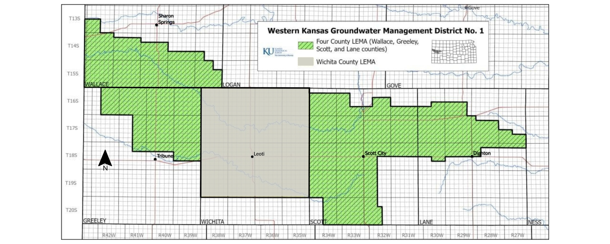
GMD1 Boundary Map highlighting the Four County LEMA areas.
The Four County LEMA is in effect 2023-2027.
The Four County LEMA covers designated areas within Wallace County, Greeley County, Scott County, and Lane County, whose portions fall inside the boundaries of Groundwater Management District No. 1. These areas are highlighted in the hashed green area shown in the image above.
Establishing the Four County LEMA
The LEMA Plan was developed by the GMD1 board and submitted to the Chief Engineer on July 1, 2022. Click the tiles to see the documents of the Four County LEMA plan.


Step-by-Step-Appeals-Guide.pdfFinal-Appeals-Process-Memorandum.pdf